On this page:
On each of these stations, the architecture is inspired by local elements.
Mombasa
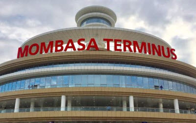 As Mombasa is a port city on the Indian Ocean, the station features concentric circles and a central tower, representing a ripple in the ocean.
Mariakani
Mariakani is a town located at the border between the two districts Kaloleni and Kinango, roughly 36 km north-west of Mombasa, and within the border of Kenya’s old Coast Province.
A lot of coconut trees grow in this area, and the porticos of the station building are inspired by them.
Miasenyi
The station building features white and brown stripes, inspired by the zebras that live in this rural part of Kenya.
Voi
 Located on the western edge of the Taru Desert, Voi is the largest town in the Taita-Taveta County, and it has the Tsavo East National park to the north and east. South of the town, you’ll see the Sagala Hills.
The railway station is V-shaped like a person with raised hands, representing the spirit of harambee. V is also the first letter of Voi.
Harambee is a Kenyan tradition of community self-help events. In Swahili, it means “all pull together”.
Mtito Andei
Mtito Andei is a small town in Makueni County, Kenya, not far from the Tanzanian border. The distance between Voi and Mtito Andei is less than 100km.
The sloping roofs of the railway station represent Mount Kilimanjaro and the Chyulu Hills.
Mtito Andei functions as a bit of a transportation hub, since it is not just on the railway but also on the Mombasa-Nairobi Road A109 and served by the Mtito Andei Airport.
Right to the east of Mtito Andei is the Tsavo National Park, and the town contains two formal entrance gates to the park.
Kibwezi
Kibwezi is a town in Makueni County. The style of the railway station here is based on traditional architecture, with leaves that shade passengers from the sun. The station is located a few kilometers from the town center.
Emali
Located in Makueni County, the town Emali straddles the border between to lifestyles: the pastoral Maasai community and the crop cultivating Kamba community. The closed fist of the railway station building represents unity.
Emali is a popular rest stop for truck drivers, which has resulted in many gas stations and many nightlife establishments.
Athi River
Athi River, also known as Mavoko, is a town in Machakos County and located very close to Nairobi. It’s named after the Athi River which flows through it. Well over 140,000 people live here and it is often referred to as a city rather than a town.
The shapes of the railway station building are inspired by the region’s hills.
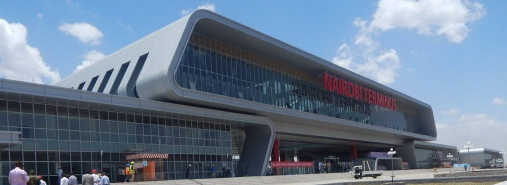
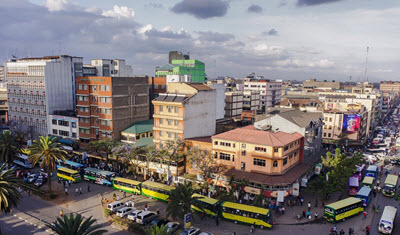 Nairobi
In 1899, Nairobi was founded as a rail depot on the Uganda Railway. This was during the British rule of East Africa, and Nairobi – located both by the River Athi and the railway – soon grew into a notable trading center for coffee, tea, and sisal produced in the colony. Within a few years, it was declared the new capital of Kenya, and it retained its status as capital when the independent Republic of Kenya was established in 1963.
The railway station building for the Nairobi stop features two trains with a bridge on top, an homage to how essential the railway is and has always been for the existence of Nairobi.
The railway station used by the new SGR is not the same as the one used by the old narrow-gauge railway. The SGR uses a newly built station called the Nairobi Terminus, located in Syokimau, about 20 km from Nairobi’s Central Business District. Syokimau is a largely residential area in western Machakos County, just south of Nairobi city proper and Jomo Kenyatta International Airport.